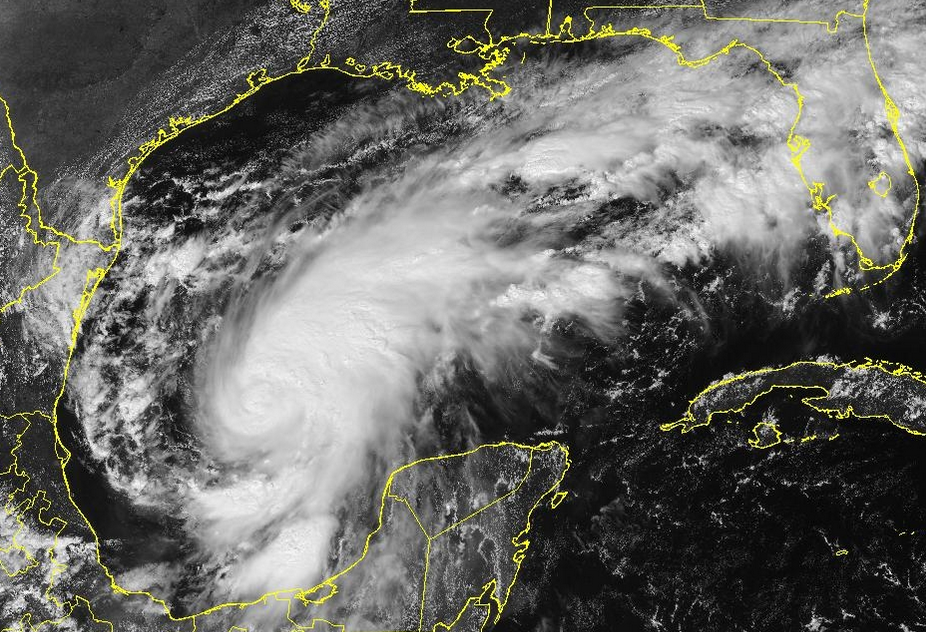
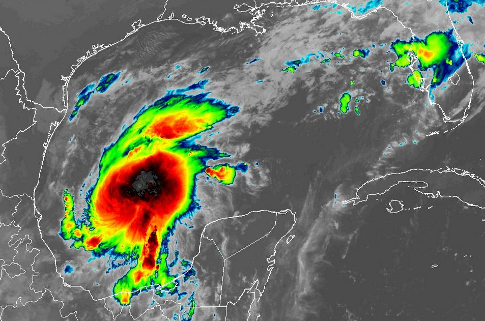
Typhoon Koguma Intensifies to Equivalent of a Major Hurricane

Typhoon Koguma intensified to the equivalent of a major hurricane east of the Northern Marianas on Friday.  At 11:00 a.m. EDT on Friday the center of Typhoon Koguma was located at latitude 20.5°N and longitude 153.5°E which put the center about 640 miles (1035 km) east-northeast of Saipan.  Koguma was moving toward the west-northwest at 17 m.p.h. (28 km/h).  The maximum sustained wind speed was 115 m.p.h. (185 km/h) and there were wind gusts to 145 m.p.h. (235 km/h).  The minimum surface pressure was 961 mb.

Typhoon Koguma intensified to the equivalent of a major hurricane on Friday as it was completing an eyewall replacement cycle.  A new larger eye was forming at the center of Koguma’s circulation.  Bands of showers and thunderstorms were revolving around the center of Typhoon Koguma.  Storms near the center of Koguma generated upper level divergence that pumped mass away from the typhoon.  The removal of mass caused the surface pressure to decrease.

Even though Typhoon Koguma was completing an eyewall replacement cycle, the circulation around Koguma was still small for a typhoon over the Western North Pacific Ocean.  Winds to typhoon force extended out 45 miles (75 km) from the center of Koguma’s circulation.  Winds to tropical storm force extended out 105 miles (165 km) from the center of Typhoon Koguma.

The Hurricane Intensity Index (HII) for Typhoon Koguma is 20.6.  The Hurricane Size Index (HSI) is 16.2 and the Hurricane Wind Intensity Size Index (HWISI) is 36.8.  Typhoon Koguma is similar in size and intensity to Hurricane Delta when Delta hit Louisiana in 2020.

Typhoon Koguma will move through an environment that will be favorable for intensification during the next 24 hours.  Koguma will move over water where the Sea Surface Temperatures are near 29°C.  It will move under the southwestern part of an upper level ridge that is over the Central North Pacific Ocean.  The upper level ridge will produce southeasterly winds that will blow toward the top of Koguma’s circulation.  Those winds will cause some vertical wind shear, but the wind shear will not be enough to prevent intensification.  Typhoon Koguma will intensify during the next 24 hours.

Typhoon Koguma will move around the southwestern part of a high pressure system that is over the Western North Pacific Ocean.  The high pressure system will steer Koguma toward the northwest during the next 24 hours.  On its anticipated track, Typhoon Koguma will pass northeast of the Northern Marianas.

Elsewhere over the Western North Pacific Ocean, Tropical Storm Nolo continued to weaken gradually far to the southeast of Japan.

At 11:00 a.m. EDT on Friday the center of Tropical Storm Nolo was located at latitude 29.7°N and longitude 147.6°E which put the center about 635 miles (1025 km) southeast of Tokyo, Japan.  Nolo was moving toward the northwest at 13 m.p.h. (21 km/h).  The maximum sustained wind speed was 60 m.p.h. (95 km/h) and there were wind gusts to 75 m.p.h. (120 km/h).  The minimum surface pressure was 991 mb.
Isaias Intensifies to a Major Hurricane

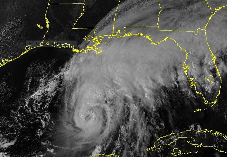
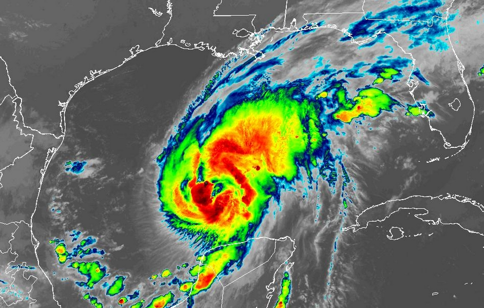
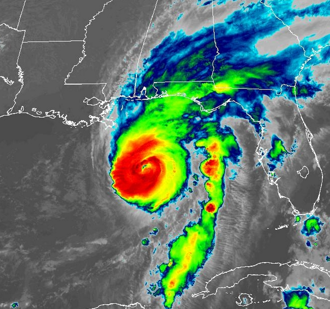
Hurricane Isaias intensified to a major hurricane early on Friday as it moved toward the northern Gulf Coast.  At 8:20 a.m. EDT on Friday the center of Hurricane Isaias was located at latitude 27.0°N and longitude 87.6°W which put the center about 240 miles (390 km) south of Pensacola, Florida.  Isaias was moving toward the north-northeast at 15 m.p.h. (24 km/h).  The maximum sustained wind speed was 120 m.p.h. (195 km/h) and there were wind gusts to 140 m.p.h. (225 km/h).  The minimum surface pressure was 959 mb.

A Hurricane Warning is in effect for the portion of the coast from Ocean Springs, Mississippi to the Bay County/ Gulf County line in Florida.  The Hurricane Warning includes Mobile, Alabama and Pensacola, Florida.

A Tropical Storm Warning is in effect for the portion of the coast from the Jefferson Parish/Plaquemines Parish line in Louisiana to Ocean Springs, Mississippi.

A Tropical Storm Warning is in effect for the portion of the coast from the Bay County/Gulf County Line to Aucilla River, Florida.

Aircraft reconnaissance found that Hurricane Isaias had intensified to a major hurricane on Friday morning.

A circular eye with a diameter of 25 miles (40 km) was at the center of Hurricane Isaias.  Bands of showers and thunderstorms were revolving around the center of Isaias’ circulation.  Storms near the center of Isaias generated upper level divergence that pumped mass away from the tropical storm.  The removal of mass caused the surface pressure to decrease.

The size of the circulation around Hurricane Isaias increased on Thursday night.  Winds to hurricane force extended out 30 miles (50 km) from the center of Isaias’ circulation.  Winds to tropical storm force extended out 185 miles (295 km) from the center of Hurricane Isaias.

The Hurricane Intensity Index (HII) for Hurricane Isaias is 22.1.  The Hurricane Size Index (HSI) is 12.0 and the Hurricane Wind Intensity Size Index (HWISI) is 34.1.  Hurricane Isaias is similar in size and intensity to Hurricane Dennis when Dennis hit Northwest Florida in 2005.

Hurricane Isaias will move through an environment that will be somewhat favorable for intensification during the next 12 hours.  Isaias will move over water where the Sea Surface Temperatures are near 30°C.  It will move under the southeastern part of an upper level trough that is over Texas.  The upper level trough will produce southwesterly winds that will blow toward the top of Isaias’ circulation.  Those winds will cause moderate vertical wind shear, but the wind shear may not be enough to prevent intensification.  Hurricane Isaias could intensify during the next 12 hours.

The upper level trough over Texas will steer Isaias toward the north during the next 24 hours. On its anticipated track, Isaias will make landfall on the northern Gulf Coast near Pensacola, Florida on Friday night.

Hurricane Isaias will bring strong winds and locally heavy rain to the northern Gulf Coast.  Heavy rain could cause flash floods in some locations.  Isaias will be capable of causing major damage.  Widespread electricity outages are likely.

Flood Watches are in effect for parts of southern Mississippi, southern Alabama, and Northwest Florida.

Isaias could cause a storm surge of up to 13 feet (4 meters) along portions of the northern Gulf Coast.

A Storm Surge Warning is in effect for the portion of the coast from the Mouth of the Mississippi River to Suwannee River, Florida.

Simon Strengthens to a Hurricane

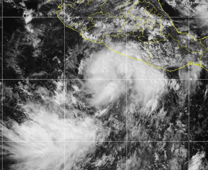
Former Tropical Storm Simon strengthened to a hurricane on Thursday evening as it moved over the Eastern North Pacific Ocean south of Mexico.  At 11:00 p.m. EDT on Thursday the center of Hurricane Simon was located at latitude 15.6°N and longitude 104.6°W which put the center about 235 miles (380 km) south of Manzanillo, Mexico.  Simon was moving toward the west-northwest at 6 m.p.h. (10 km/h).  The maximum sustained wind speed was 75 m.p.h. (120 km/h) and there were wind gusts to 90 m.p.h. (145 km/h).  The minimum surface pressure was 985 mb.

A Hurricane Warning is in effect for the portion of the coast from Punta San Telmo to Punta Mita, Mexico.

A Tropical Storm Watch is in effect for the portion of the coast from Punta San Telmo to Lazaro Cardenas, Mexico.

Former Tropical Storm Simon strengthened to a hurricane on Friday evening.

Tall thunderstorms formed near the center of Hurricane Simon.  Bands of showers and thunderstorms were revolving around the center of Simon’s circulation.  Storms near the center of Simon generated upper level divergence that pumped mass away from the hurricane.  The removal of mass caused the surface pressure to decrease.

The circulation around Hurricane Simon was small.  The strongest winds were occurring in the northeastern part of Simon’s circulation.  Winds to hurricane force extended out 20 miles in the northeastern quadrant of Simon.  Winds to tropical storm force extended out 90 miles (145 km) from the center of Hurricane Simon.

Hurricane Simon will move through an environment favorable for intensification during the next 24 hours.  Simon will move over water where the Sea Surface Temperatures are near 30°C. It will move under the middle of an upper level ridge that is over Mexico and the Eastern North Pacific Ocean.  The upper level ridge winds are weak near the middle of the ridge and there will be little vertical wind shear.  Hurricane Simon will intensify during the next 24 hours.  Simon could intensify rapidly at times.  Hurricane Simon could strengthen to a major hurricane on Friday.

Hurricane Simon will move around the western part of a high pressure system that is over Mexico.  The high pressure system will steer Simon toward the north during the next 24 hours. Hurricane Simon will approach the west coast of Mexico on Saturday.

Hurricane Simon is likely to be a major hurricane when it hits the west coast of Mexico.  Simon will bring strong winds and locally heavy rain to the west coast of Mexico.  The strongest winds and heaviest rains will occur in Jalisco and Nayarit.  Heavy rain is likely to cause flash floods in some locations.  Hurricane Simon could cause a storm surge of up to 13 feet (4 meters) along parts of the west coast of Mexico.

Elsewhere over the Eastern North Pacific Ocean, Tropical Storm Rachel continued to weaken gradually west of Baja California.

At 11:00 p.m. EDT on Thursday the center of Tropical Storm Rachel was located at latitude 22.6°N and longitude 125.5°W which put the center about 995 miles (1600 km) west of the southern tip of Baja California.  Rachel was moving toward the west-northwest at 6 m.p.h. (10 km/h).  The maximum sustained wind speed was 60 m.p.h. (95 km/h) and there were wind gusts to 75 m.p.h. (120 km/h).  The minimum surface pressure was 990 mb.

Koguma Strengthens to a Typhoon

Former Tropical Storm Koguma strengthened to a typhoon over the Western North Pacific Ocean east of the Northern Marianas on Thursday.  At 5:00 p.m. EDT on Thursday the center of Typhoon Koguma was located at latitude 18.4°N and longitude 157.1°E which put the center about 810 miles (1310 km) east-northeast of Saipan.  Koguma was moving toward the west-northwest at 14 m.p.h. (22 km/h).  The maximum sustained wind speed was 85 m.p.h. (135 km/h) and there were wind gusts to 105 m.p.h. (165 km/h).  The minimum surface pressure was 980 mb.

Former Tropical Storm Koguma strengthened to a typhoon on Thursday.  The inner end of a rainband wrapped around the southern side of the center of Koguma’s circulation.  Other bands of showers and thunderstorms were revolving around the center of Typhoon Koguma.  Storms near the center of Koguma generated upper level divergence that pumped mass away from the typhoon.  The removal of mass caused the surface pressure to decrease.

The distribution of wind speeds in Typhoon Koguma was fairly symmetrical.  Winds to typhoon force extended out 30 miles (50 km) from the center of Koguma’s circulation.  Winds to tropical storm force extended out 105 miles (165 km) from the center of Typhoon Koguma.

Typhoon Koguma will move through an environment that will be favorable for intensification during the next 24 hours.  Koguma will move over water where the Sea Surface Temperatures are near 29°C.  It will move under the southwestern part of an upper level ridge that is over the Central North Pacific Ocean.  The upper level ridge will produce easterly winds that will blow toward the top of Koguma’s circulation.  Those winds will cause some vertical wind shear, but the wind shear will not be enough to prevent intensification.  Typhoon Koguma will intensify during the next 24 hours.  Koguma could strengthen to the equivalent of a major hurricane during the weekend.

Typhoon Koguma will move around the southwestern part of a high pressure system that is over the Western North Pacific Ocean.  The high pressure system will steer Koguma toward the west-northwest during the next 24 hours.  On its anticipated track, Typhoon Koguma will pass northeast of the Northern Marianas.

Elsewhere over the Western North Pacific Ocean, Tropical Storm Nolo was weakening gradually far to the southeast of Japan.

At 5:00 p.m. EDT on Thursday the center of Tropical Storm Nolo was located at latitude 28.1°N and longitude 150.6°E which put the center about 855 miles (1380 km) east-southeast of Tokyo, Japan.  Nolo was moving toward the west-northwest at 17 m.p.h. (28 km/h).  The maximum sustained wind speed was 60 m.p.h. (95 km/h) and there were wind gusts to 75 m.p.h. (120 km/h).  The minimum surface pressure was 991 mb.
Hurricane Isaias Intensifies to Cat. 2

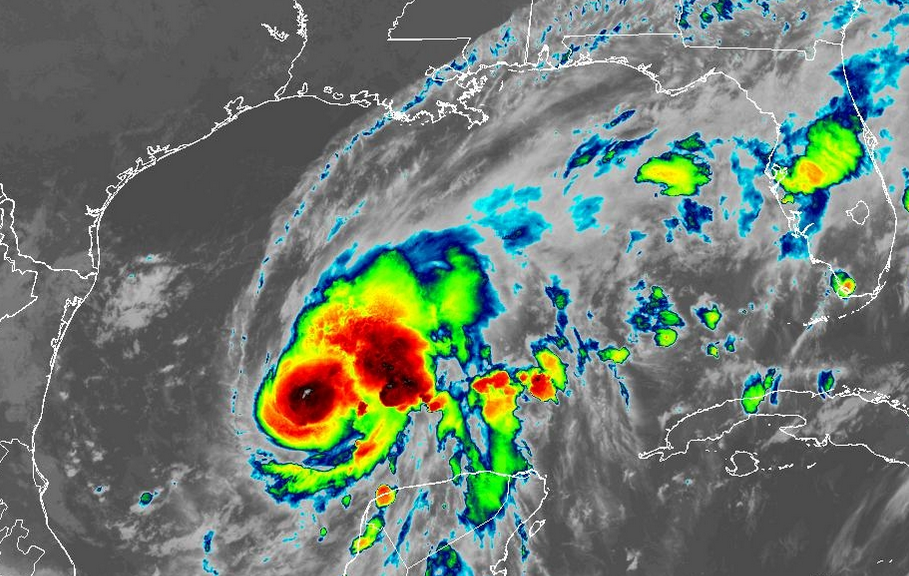
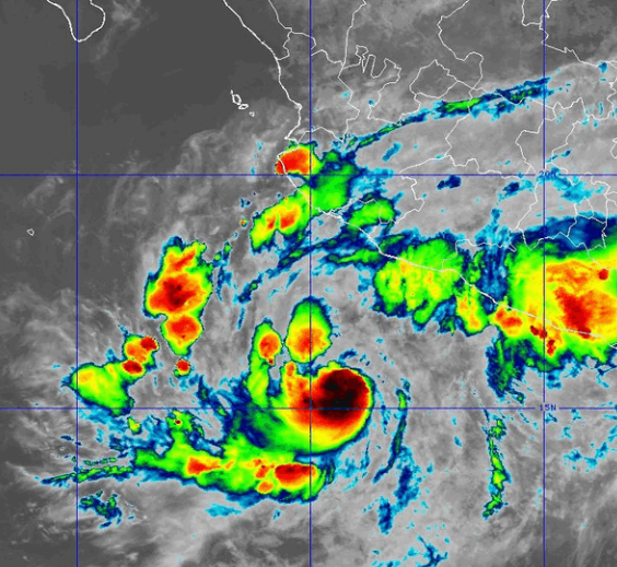
Hurricane Isaias intensified to Category 2 on the Saffir-Simpson Scale on Thursday afternoon.  At 5:00 p.m. EDT on Thursday the center of Hurricane Isaias was located at latitude 24.4°N and longitude 89.3°W which put the center about 325 miles (525 km) south of the Mouth of the Mississippi River.  Isaias was moving toward the northeast at 12 m.p.h. (19 km/h).  The maximum sustained wind speed was 100 m.p.h. (160 km/h) and there were wind gusts to 120 m.p.h. (195 km/h).  The minimum surface pressure was 975 mb.

A Hurricane Warning is in effect for the portion of the coast from Ocean Springs, Mississippi to the Bay County/ Gulf County line in Florida.  The Hurricane Warning includes Mobile, Alabama and Pensacola, Florida.

A Tropical Storm Warning is in effect for the portion of the coast from the Jefferson Parish/Plaquemines Parish line in Louisiana to Ocean Springs, Mississippi.

A Tropical Storm Warning is in effect for the portion of the coast from the Bay County/Gulf County Line to Aucilla River, Florida.

Hurricane Isaias intensified to Cat. 2 on the Saffir- Simpson Scale on Thursday afternoon.

The inner end of a rainband wrapped around the center of Isaias’ circulation.  A circular eye with a diameter of 30 miles (50 km) formed at the center of Hurricane Isaias.  Bands of showers and thunderstorms were revolving around the center of Isaias’ circulation.  Storms near the center of Isaias generated upper level divergence that pumped mass away from the tropical storm.  The removal of mass caused the surface pressure to decrease.

The distribution of wind speeds in Hurricane Isaias became more symmetrical on Thursday afternoon.  Winds to hurricane force extended out 20 miles (30 km) from the center of Isaias’ circulation.  Winds to tropical storm force extended out 130 miles (210 km) from the center of Hurricane Isaias.

The Hurricane Intensity Index (HII) for Hurricane Isaias is 16.5.  The Hurricane Size Index (HSI) is 8.6 and the Hurricane Wind Intensity Size Index (HWISI) is 25.1.  Hurricane Isaias is similar in size and intensity to Hurricane Idalia when Idalia hit Florida in 2023.

Hurricane Isaias will move through an environment that will be favorable for intensification during the next 18 hours.  Isaias will move over water where the Sea Surface Temperatures are near 30°C.  It will move under the southeastern part of an upper level trough that is over the South Central U.S.  The upper level trough will produce westerly winds that will blow toward the top of Isaias’ circulation.  Those winds will cause some vertical wind shear, but the wind shear will not be enough to prevent intensification.  Hurricane Isaias is likely to intensify during the next 18 hours.  Isaias could strengthen to a major hurricane.

Hurricane Isaias will move around the southeastern part of the upper level trough that is over the South Central U.S.   The upper level trough will steer Isaias toward the north-northeast during the next 24 hours.  On its anticipated track, Isaias will reach the northern Gulf Coast on Friday night.

Hurricane Isaias will bring strong winds and locally heavy rain to the northern Gulf Coast.  Heavy rain could cause flash floods in some locations.  Isaias will be capable of causing serious damage.  Widespread electricity outages are likely.

Flood Watches are in effect for parts of southern Mississippi, southern Alabama, and Northwest Florida.

Isaias could cause a storm surge of up to 12 feet (3.6 meters) along portions of the northern Gulf Coast.

A Storm Surge Warning is in effect for the portion of the coast from the Mouth of the Mississippi River to Suwannee River, Florida.

Isaias Strengthens to a Hurricane

Former Tropical Storm Isaias strengthened to a hurricane as it moved over the central Gulf of Mexico on Wednesday night.  At 8:00 a.m. EDT on Thursday the center of Hurricane Isaias was located at latitude 23.7°N and longitude 90.6°W which put the center about 385 miles (620 km) south-southwest of the Mouth of the Mississippi River.  Isaias was moving toward the east-northeast at 9 m.p.h. (15 km/h).  The maximum sustained wind speed was 80 m.p.h. (130 km/h) and there were wind gusts to 95 m.p.h. (150 km/h).  The minimum surface pressure was 975 mb.

A Hurricane Warning is in effect for the portion of the coast from Ocean Springs, Mississippi to the Bay County/ Gulf County line in Florida.  The Hurricane Warning includes Mobile, Alabama and Pensacola, Florida.

A Tropical Storm Warning is in effect for the portion of the coast from the Jefferson Parish/Plaquemines Parish line in Louisiana to Ocean Springs, Mississippi.

A Tropical Storm Warning is in effect for the portion of the coast from the Bay County/Gulf County Line to Aucilla River, Florida.

Former Tropical Storm Isaias strengthened to a hurricane on Wednesday night.

The inner end of a rainband wrapped around the western and southern sides of the center of Hurricane Isaias.  An eye appeared to be forming at the center of Isaias’ circulation.  Bands of showers and thunderstorms were revolving around the center of Isaias’ circulation.  Storms near the center of Isaias generated upper level divergence that pumped mass away from the tropical storm.  The removal of mass caused the surface pressure to decrease.

The strongest winds were occurring in the rainband that wrapped around the western side of the center of Hurricane Isaias.  Winds to hurricane force extended out 20 miles (30 km) in the western side of Isaias’ circulation.  Winds to tropical storm force extended out 90 miles (145 km) from the center of Hurricane Isaias.

Hurricane Isaias will move through an environment that will be favorable for intensification during the next 24 hours.  Isaias will move over water where the Sea Surface Temperatures are near 30°C.  It will move under the southeastern part of an upper level trough that is over the South Central U.S.  The upper level trough will produce westerly winds that will blow toward the top of Isaias’ circulation.  Those winds will cause some vertical wind shear, but the wind shear will not be enough to prevent intensification.  Hurricane Isaias will intensify during the next 24 hours.

Hurricane Isaias will move around the southeastern part of the upper level trough that is over the South Central U.S.   The upper level trough will steer Isaias toward the northeast during the next 24 hours.  On its anticipated track, Isaias will reach the northern Gulf Coast on Friday night.

Hurricane Isaias will bring strong winds and locally heavy rain to the northern Gulf Coast.  Heavy rain could cause flash floods in some locations.

Flood Watches are in effect for parts of southern Mississippi, southern Alabama, and Northwest Florida.

Isaias could cause a storm surge of up to 12 feet (3.6 meters) along portions of the northern Gulf Coast.

A Storm Surge Warning is in effect for the portion of the coast from the Mouth of the Mississippi River to Steinhatchee River, Florida.


Hurricane Warning issued for Northern Gulf Coast

A Hurricane Warning was issued for a portion of the northern Gulf Coast on Wednesday night because of the threat posed by Tropical Storm Isaias.  At 11:00 p.m. EDT on Wednesday the center of Tropical Storm Isaias was located at latitude 22.9°N and longitude 91.9°W which put the center about 460 miles (745 km) south-southwest of the Mouth of the Mississippi River.  Isaias was moving toward the east-northeast at 9 m.p.h. (15 km/h).  The maximum sustained wind speed was 70 m.p.h. (110 km/h) and there were wind gusts to 85 m.p.h. (135 km/h).  The minimum surface pressure was 988 mb.

A Hurricane Warning is in effect for the portion of the coast from Ocean Springs, Mississippi to the Bay County/ Gulf County line in Florida.

A Tropical Storm Warning is in effect for the portion of the coast from the Jefferson Parish/Plaquemines Parish line in Louisiana to Ocean Springs, Mississippi.

A Tropical Storm Warning is in effect for the portion of the coast from the Bay County/Gulf County Line to Aucilla River, Florida.

Tropical Storm Isaias continued to intensify on Wednesday evening.  Isaias was on the threshold of becoming a hurricane.

Bands of showers and thunderstorms were revolving around the center of Isaias’ circulation.  Storms near the center of Isaias generated upper level divergence that pumped mass away from the tropical storm.  The removal of mass caused the surface pressure to decrease.

The distribution of wind speeds in Tropical Storm Isaias was fairly symmetrical.  Winds to tropical storm force extended out 60 miles (95 km) from the center of Isaias’ circulation.

Tropical Storm Isaias will move through an environment that will be favorable for intensification during the next 24 hours.  Isaias will move over water where the Sea Surface Temperatures are near 30°C.  It will move under the middle of an upper level ridge that is over the Gulf of Mexico.  The upper level winds are weak near the middle of the ridge and there will be little vertical wind shear.  Tropical Storm Isaias will intensify during the next 24 hours.  Isaias could intensify rapidly at times.  Tropical Storm Isaias will strengthen to a hurricane by Thursday morning.

Tropical Storm Isaias will move around the southeastern part of an upper level trough that is over the Southern Plains.  The upper level trough will steer Isaias toward the northeast during the next 24 hours.  On its anticipated track, Isaias will reach the northern Gulf Coast on Friday night.

Tropical Storm Isaias will be a hurricane when it reaches the northern Gulf Coast.  Isaias could be a major hurricane when it reaches the coast.  Isaias will bring strong winds and locally heavy rain to the northern Gulf Coast.  Heavy rain could cause flash floods in some locations.

Isaias could cause a storm surge of up to 12 feet (3.6 meters) along portions of the northern Gulf Coast.

A Storm Surge Warning is in effect for the portion of the coast from the Mouth of the Mississippi River to Steinhatchee River, Florida.

Tropical Storm Simon Forms South of Mexico

Tropical Storm Simon formed over the Eastern North Pacific Ocean south of Mexico on Wednesday.  At 5:00 p.m. EDT on Wednesday the center of Tropical Storm Simon was located at latitude 15.5°N and longitude 101.6°W which put the center about 175 miles (285 km) south-southeast of Lazaro Cardenas, Mexico.  Simon was moving toward the west-northwest at 8 m.p.h. (13 km/h).  The maximum sustained wind speed was 40 m.p.h. (65 km/h) and there were wind gusts to 50 m.p.h. (80 km/h).  The minimum surface pressure was 1004 mb.

A low pressure system over the Eastern North Pacific Ocean south of Mexico strengthened on Wednesday and the U.S. National Hurricane Center designated the system as Tropical Storm Simon.

Tropical Storm Simon exhibited better organization on Wednesday afternoon.  More thunderstorms were forming near the center of Simon’s circulation.  More thunderstorms also started to develop in bands revolving around the center of Tropical Storm Simon.  Storms near the center of Simon began to generate upper level divergence that pumped mass away from the tropical storm.  The removal of mass cause the surface pressure to start to decrease.

The strongest winds were occurring in the northeastern part of Tropical Storm Simon.  Winds to tropical storm force extended out 70 miles (110 km) in the northeastern quadrant of Simon’s circulation.  The winds in the other parts of Tropical Storm Simon were blowing at less than tropical storm force.

Tropical Storm Simon will move through an environment favorable for intensification during the next 24 hours.  Simon will move over water where the Sea Surface Temperatures are near 30°C.  It will move under the southern part of an upper level ridge that is over Mexico.  The upper level ridge will produce easterly winds that will blow toward the top of Simon’s circulation.  Those winds will cause some vertical wind shear, but the wind shear will not be enough to prevent intensification.  Tropical Storm Simon will intensify during the next 24 hours.

Tropical Storm Simon will move around the western part of a high pressure system that is over Mexico.  The high pressure system will steer Simon toward the west-northwest during the next 24 hours.  Simon will start to move toward the north on Friday when it reaches the western end of the high pressure system.  On its anticipated track, Tropical Storm Simon could approach the west coast of Mexico on Saturday.

Elsewhere over the Eastern North Pacific Ocean, Hurricane Rachel was still spinning west of Baja California.

At 5:00 p.m. EDT on Wednesday the center of Hurricane Rachel was located at latitude 21.2°N and longitude 122.3°W which put the center about 800 miles (1290 km) west of the southern tip of Baja California.  Rachel was moving toward the west-northwest at 7 m.p.h. (11 km/h).  The maximum sustained wind speed was 80 m.p.h. (130 km/h) and there were wind gusts to 100 m.p.h. (160 km/h).  The minimum surface pressure was 979 mb.

Hurricane Watch Issued for Northern Gulf Coast

A Hurricane Watch was issued for a portion of the northern Gulf Coast on Wednesday because of the threat posed by Tropical Storm Isaias.  At 2:00 p.m. EDT on Wednesday the center of Tropical Storm Isaias was located at latitude 22.6°N and longitude 93.4°W which put the center about 520 miles (840 km) south-southwest of the Mouth of the Mississippi River.  Isaias was moving toward the east-northeast at 8 m.p.h. (13 km/h).  The maximum sustained wind speed was 50 m.p.h. (80 km/h) and there were wind gusts to 65 m.p.h. (105 km/h).  The minimum surface pressure was 997 mb.

A Hurricane Watch is in effect for the portion of the coast from Bay St. Louis, Mississippi to Indian Pass, Florida.

A Tropical Storm Watch is in effect for the portion of the coast from the Jefferson Parish/Plaquemines Parish line in Louisiana to Bay St. Louis, Mississippi.

A Tropical Storm Watch is in effect for the portion of the coast from Indian Pass to Aucilla River, Florida.

Tropical Storm Isaias was strengthening on Wednesday afternoon.

New thunderstorms continued to develop near the center of Tropical Storm Isaias.  Thunderstorms were also occurring in bands that were revolving around the center of Isaias’ circulation.  Storms near the center of Isaias generated more upper level divergence that pumped more mass away from the tropical storm.  The removal of more mass caused the surface pressure to decrease.

The distribution of wind speeds in Tropical Storm Isaias was becoming more symmetrical.  Winds to tropical storm force extended out 45 miles (75 km) from the center of Isaias’ circulation.

Tropical Storm Isaias will move through an environment that will be favorable for intensification during the next 24 hours.  Isaias will move over water where the Sea Surface Temperatures are near 30°C.  It will move under the middle of an upper level ridge that is over the Gulf of Mexico.  The upper level winds are weak near the middle of the ridge and there will be little vertical wind shear.  Tropical Storm Isaias will intensify during the next 24 hours.  Isaias could intensify rapidly.  Tropical Storm Isaias could strengthen to a hurricane by Thursday morning.

An upper level trough over the eastern U.S. and the Gulf of Mexico will steer Tropical Storm Isaias toward the east-northeast during the next 24 hours.  A different upper level trough approaching from the Southern Plains west will start to steer Isaias toward the north on Thursday.  Tropical Storm Isaias could reach the northern Gulf Coast by Friday night.

Tropical Storm Isaias is likely to be a hurricane when it reaches the northern Gulf Coast.  Isaias could be a major hurricane when it reaches the coast.  Isaias will bring strong winds and locally heavy rain to the northern Gulf Coast.  Heavy rain could cause flash floods in some locations.

Tropical Storm Isaias could cause a storm surge of up to 12 feet (3.6 meters) along portions of the northern Gulf Coast.

A Storm Surge Watch is in effect for the portion of the coast from the Mouth of the Mississippi River to Yankeetown, Florida.

Depression Strengthens to Tropical Storm Isaias

Former Tropical Depression Nine strengthened to Tropical Storm Isaias over the southwestern Gulf of Mexico early on Wednesday.  At 5:00 a.m. EDT on Wednesday the center of Tropical Storm Isaias was located at latitude 22.0°N and longitude 94.1°W which put the center about 285 miles (460 km) west of Progreso, Mexico.  Isaias was moving toward the east-northeast at 8 m.p.h. (13 km/h).  The maximum sustained wind speed was 40 m.p.h. (65 km/h) and there were wind gusts to 50 m.p.h. (80 km/h).  The minimum surface pressure was 1004 mb.

Former Tropical Depression Nine strengthened to Tropical Storm Isaias early on Wednesday.

More thunderstorms were developing near the center of Tropical Storm Isaias.  More thunderstorms were also occurring in bands that were revolving around the center of Isaias’ circulation.  Storms near the center of Isaias generated more upper level divergence that pumped more mass away from the tropical storm.  The removal of more mass caused the surface pressure to decrease.

The strongest winds were occurring in the northern side of Tropical Storm Isaias.  Winds to tropical storm force extended out 45 miles in the northern half of Isaias’ circulation.  The winds in the southern half of Tropical Storm Isaias were blowing at less than tropical storm force.

Tropical Storm Isaias will move through an environment that will be favorable for intensification during the next 24 hours.  Isaias will move over water where the Sea Surface Temperatures are near 30°C.  It will move under the middle of an upper level ridge that is over the Gulf of Mexico. The upper level winds are weak near the middle of the ridge and there will be little vertical wind shear.  Tropical Storm Isaias will intensify during the next 24 hours.  Isaias could intensify rapidly.  Tropical Storm Isaias could strengthen to a hurricane by Wednesday night.

An upper level trough over the eastern U.S. and the Gulf of Mexico will steer Tropical Storm Isaias toward the east-northeast during the next 24 hours.  On its anticipated track, Tropical Storm Isaias will move closer to the northwestern part of the Yucatan Peninsula.  A different upper level trough approaching from the Southern Plains west will start to steer Isaias toward the north on Wednesday night.  Tropical Storm Isaias could reach the northern Gulf Coast by Friday night.

Tropical Storm Isaias is likely to be a hurricane when it reaches the northern Gulf Coast.  Isaias could be a major hurricane when it reaches the coast.

A Hurricane Watch will likely be issued for a portion of the northern Gulf Coast later today.